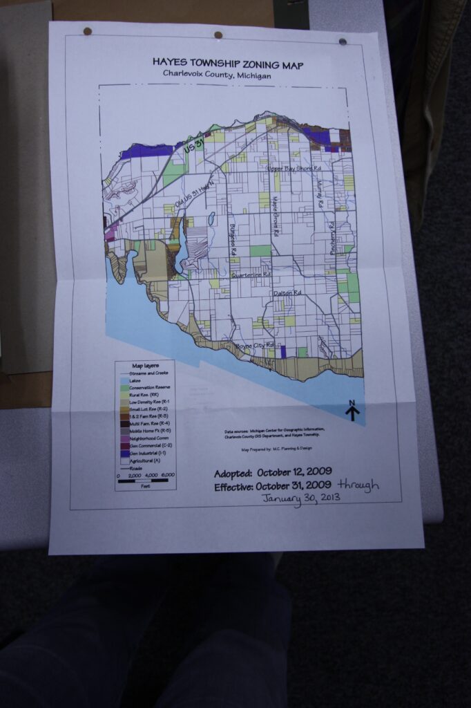
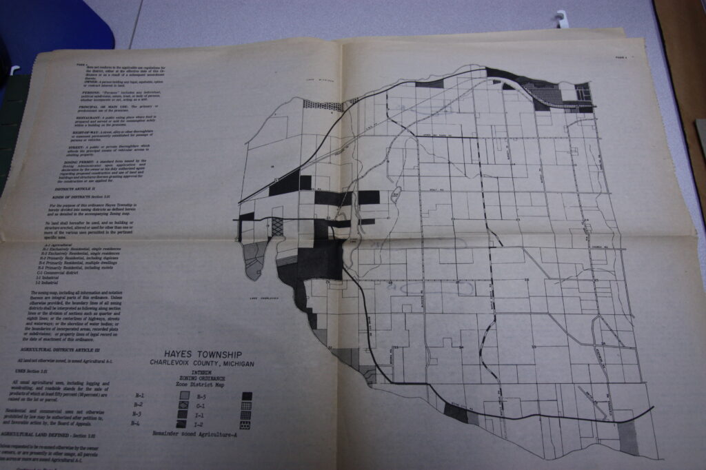
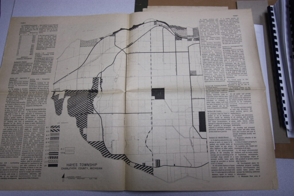
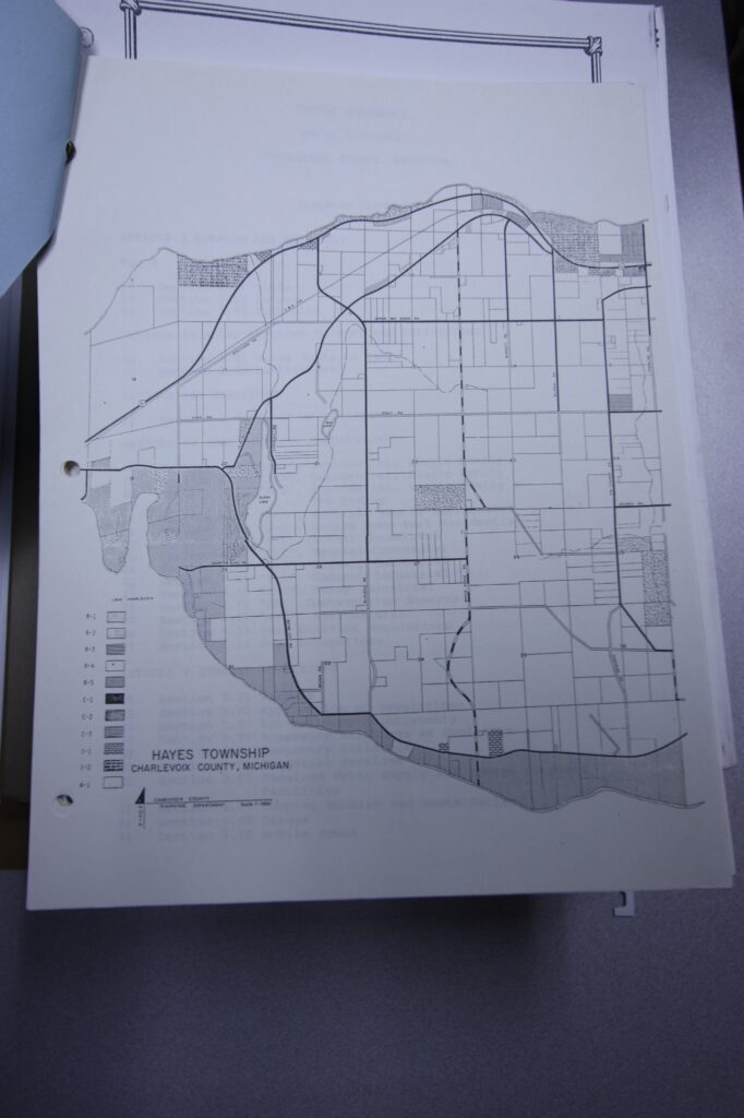
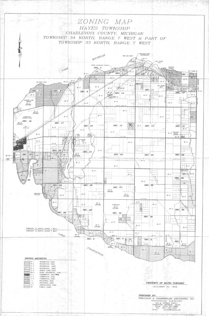
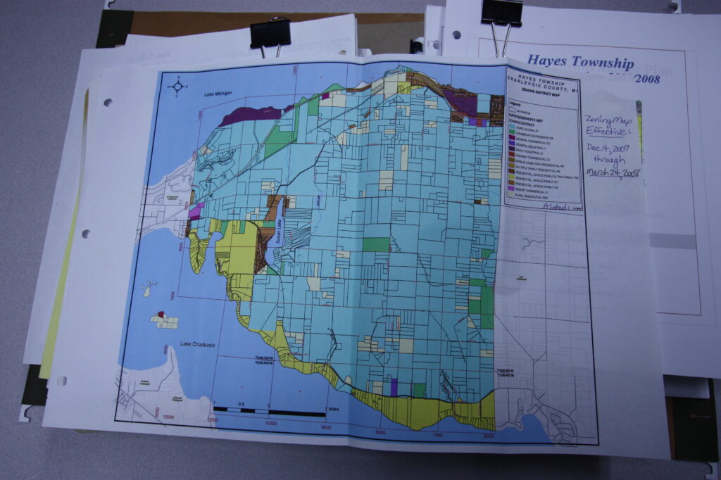
As you can see by comparing the zoning maps of Hayes Township (Charlevoix County, Michigan) through time, beginning with the first zoning map (and ordinance) adopted in 1974, the interior of the township remains largely agricultural through time, while a scenic corridor and some commercial development occurs along US-Highway 31, along Lake Michigan. The historic village of Bay Shore in the upper northeast corner predates zoning in the township.
All of the Lake Charlevoix waterfront parcels in Hayes Township is soon zoned residential, R-1, ‘low density relatively quiet,’ after some parcels start off as Agricultural, but all lands along the shore are forested, not “prime agricultural land.” A corner along Lake Michigan begins as Agricultural and develops as a Planned Unit Development by 1999. Around Susan Lake, the west side is zoned residential while the eastern shore is zoned agricultural to this day. A large agricultural-zoned parcel in Bay Shore remains undeveloped and in 2024, the Little Traverse Conservancy set it aside as a conservation area.
An early industrial site is in the upper northeast corner, and the Big Rock Point nuclear plant located on Lake Michigan in the northwest corner pre-dates zoning in the township. There is no town commercial center.
1974 Hayes Township’s first zoning map
1979 Zoning Map
1985 Zoning Map
1999 Zoning Map
2008 Zoning Map
2013 Zoning map
